Projet du CEN / CEN project
Informations: TEG1_2_Drained
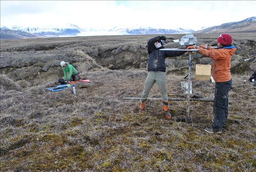
Forage en cours dans un polygon érodé adjacent au ravin. Crédit photo: Etienne Godin 19/06/2013
Ongoing drilling in an eroded polygon next to the gully. Photo credit: Etienne Godin 19/06/2013
Site de mesure / Measurement site
Latitude :
73.157
Longitude :
-79.9469
Altitude (m) :
20
Localisation du site / Site location
Forage sur un polygone drainé adjacent au ravin.
Borehole in a drained polygon adjacent to the gully.
Description du site / Site description
Forage de 1.14 m de profond dans une zone où le ravin avait 5 ans lors du forage.
Borehole 1.14 m deep in an area where the gully was 5 years old during drilling.