Projet du CEN / CEN project
Informations: Plot 5
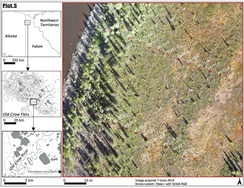
Carte et photo aérienne des transects de Plot 5. Crédit: Kevin Turner, 7 juin 2019
Plot 5 map and aerial photo of the transects. Credit: Kevin Turner, 7 juin 2019
Site de mesure / Measurement site
Latitude :
67.8415
Longitude :
-139.758
Altitude (m) :
271.152
Localisation du site / Site location
Site dans une zone ouverte sur une terrasse fluviatile
Site in an open area on a river terrace
Description du site / Site description
Le site est situé sur une terrasse fluviale. Il commence dans une zone ouverte plate et se termine au niveau d’une pente menant à un bras mort (oxbow lake). La couverture de surface dans la zone plate est de la toundra dominée par des tussocks alors que la pente est dominée par une forêt d’épinettes.
The site is located on a fluvial terrace. It begins in a flat open area and ends on a slope leading down to an oxbow lake. The land cover in the flat area is tussock tundra and is spruce forest on the slope.